Show Posts

This section allows you to view all posts made by this member. Note that you can only see posts made in areas you currently have access to.


Messages - profy

Pages: 1 2 3 4
31
Mapping / Re: Profy's Maps
« on: January 20, 2018, 02:02:50 pm »
Hey!

The IVe Corps event of 17/01/18 on the map of the Montmélian Citadel filmed by Chadtopia !


32
Mapping / Re: Profy's Maps
« on: January 18, 2018, 02:27:02 pm »
Hello !
Following the recent patch, I updated some maps:

- Citadel of Montmelian

   - Bug fixes and addition of invisible walls
   - Debug of a cannon
   - Fixed a bug that allowed spawn defenders behind enemy lines

- Fort de la Conchée

   - Added a teleportation door to access the frigate and use the cannons
   - Changing how to approach the fort
   - Updated screenshots on the first page
Spoiler


[close]

- Fort-les-Bancs V2

   - adding new props
   - fix a wall that crashed the server

- Line battle - Arid Land -

   - Added a screenshot on the first page

Spoiler
[close]

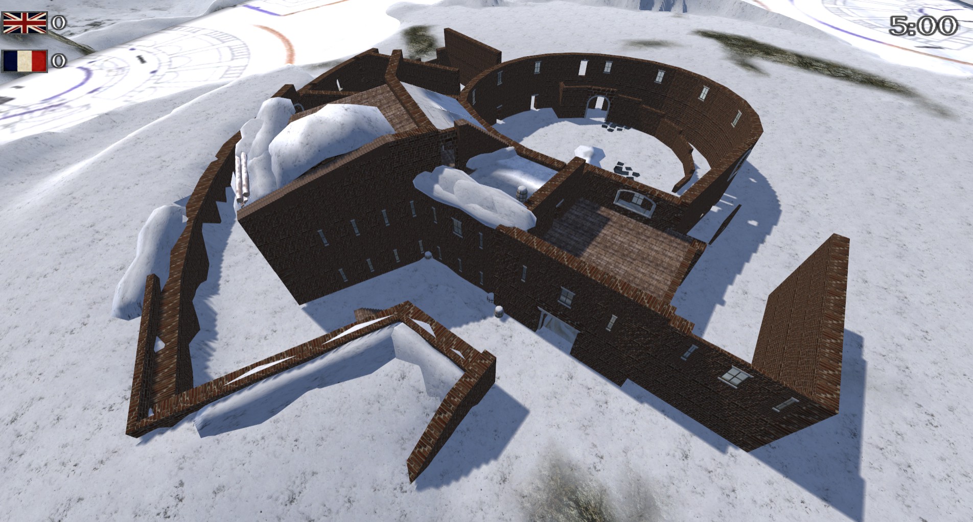
- Line Battle - Winter Hideaway -

   - Fixed bug buildings following the update

- Line Battle - The Man of the Woods -

   - Fixed bug buildings following the update


That's all for today ! If you ever find bugs of any kind, please do not hesitate to warn me Via Steam or on this topic!

33
Mapping / Re: Profy's Maps
« on: January 09, 2018, 02:30:17 pm »
Hi

Citadelle de Montmélian
V1.01

- Addition of invisible walls in the corners of walls and in some places

- Corrections of some bugs to go under the map

34
Mapping / Re: Profy's Maps
« on: January 04, 2018, 03:25:40 pm »
Happy new year!

The first Topic as updated and the missing images and links have been replaced.

35
Et en temps qu'homme de rang, ont devrait se méfier de ces trois là ^^

36
Mapping / Re: Profy's Maps
« on: December 20, 2017, 12:00:32 pm »
I have a test server available: Profy_Map_Test (20 slots)
Do not hesitate to take a look at it and test the available maps !

You can tell me about bugs or comments via Steam (Le Profyteur) or here.

List of maps:

- Charge_to_the_rhine --> Citadelle de Montmélian
- Citadelle_Napoleon --> Fort de la Conchée
- Fort_Mackinaw_raining --> Fort les Bancs V2

Other maps will come complete the server

37
Mapping / Re: Profy's Maps
« on: December 19, 2017, 09:46:08 pm »
Thanks :D

38
Mapping / Re: Help with maps for new NW Patch.
« on: December 19, 2017, 02:29:16 pm »

Citadelle de Montmélian


A bit of history about the place:

Quote
The village of Montmélian is the former military and administrative capital of the Counts of Savoy before the purchase of Chambéry. Strategically placed on the crossroads between the Dauphiné, Val du Bourget, via Chambery, and the Combe de Savoie leading to the valleys of Maurienne and Tarentaise intra-alpine, passages to Piedmont, the village was very soon completed by a fortress without ceases to be adapted to military developments. Following the French occupation of the early sixteenth century by the King of France, François I, Duke Emmanuel Philibert is modernizing the citadel by the engineer Dominique Revel de Savonne from 1561, with the addition of an artillery. The duke wants it to become "a stronghold not only the best of Savoy but the best in Europe".

At the end of the sixteenth century, the citadel of Montmelian was one of the most famous citadels in Europe. Built on a rock accessible only on the city side and located above it, it is equipped with 30 pieces of guns and 20,000 hits in reserve. Besides, the old castle had been joined with a new citadel, in the midst of which he was shut up. Its enclosure covered the entire summit of the rock. The square was now flanked by 5 large bastions, the 3 most important face the city, located at the foot of the mountain. The three bastions, the foundations of which were one and a half feet deep in the living rock, could not be undermined or mined. The access ramp was cut by a wide and deep ditch, chiseled into the granite9. On the other side, the rocks too steep did not allow to build advanced works, it is defended by long pincers10.

Faced with the French invasion, the Comte de Brandis, commander of the place, announced that the citadel will be "the cemetery of the French"

The seat of the citadel

Montmélian en 1675, gravure de Romeyn de Hooghe.
Spoiler
[close]

After returning to Tarentaise and chasing the Savoyard troops beyond the Petit-Saint-Bernard pass, Lesdiguières took a position at Moutiers to wait for the relief troops to clear Montmelian.
The threat of attack by the Savoyard troops did not frighten the French. The duke of Sully received the authorization of the King of France to besiege with all his artillery the fortress of Montmelian.

The place, commanded by Count de Brandis, is defended by 300 garrison men and 30 guns on the ramparts. In the South it is protected by the Isère that crosses on a bridge to go further in Savoy. To the north, it is surrounded by very high mountains, at the foot of which rises a hill planted with very steep vines.

Before fully engaging in hostilities, the French Command summoned the governor of the place to surrender. But he rejected the proposal with contempt and replied, "If the King approached Montmelian, the glory of the name François would find his tomb there."

But the conflicts between Savoy and France persist, and in 1630 Louis XIII and Richelieu resume Chambery May 17 besiege Montmelian. Despite a siege of thirteen months, the citadel commanded by Jaffre de Bens de Cavour does not capitulate; Louis XIV will besiege it also in 1691 and in 1701.

Taken, the citadel is destroyed in 1706, by order of the king of France and the council of Vauban. The hill that greeted it is now bare and has become a belvedere.


Spoiler
[close]
Spoiler
[close]
Spoiler
[close]

Quote

39
Mapping / Re: Profy's Maps
« on: December 19, 2017, 02:27:29 pm »
Citadelle de Montmélian


A bit of history about the place:

Quote
The village of Montmélian is the former military and administrative capital of the Counts of Savoy before the purchase of Chambéry. Strategically placed on the crossroads between the Dauphiné, Val du Bourget, via Chambery, and the Combe de Savoie leading to the valleys of Maurienne and Tarentaise intra-alpine, passages to Piedmont, the village was very soon completed by a fortress without ceases to be adapted to military developments. Following the French occupation of the early sixteenth century by the King of France, François I, Duke Emmanuel Philibert is modernizing the citadel by the engineer Dominique Revel de Savonne from 1561, with the addition of an artillery. The duke wants it to become "a stronghold not only the best of Savoy but the best in Europe".

At the end of the sixteenth century, the citadel of Montmelian was one of the most famous citadels in Europe. Built on a rock accessible only on the city side and located above it, it is equipped with 30 pieces of guns and 20,000 hits in reserve. Besides, the old castle had been joined with a new citadel, in the midst of which he was shut up. Its enclosure covered the entire summit of the rock. The square was now flanked by 5 large bastions, the 3 most important face the city, located at the foot of the mountain. The three bastions, the foundations of which were one and a half feet deep in the living rock, could not be undermined or mined. The access ramp was cut by a wide and deep ditch, chiseled into the granite9. On the other side, the rocks too steep did not allow to build advanced works, it is defended by long pincers10.

Faced with the French invasion, the Comte de Brandis, commander of the place, announced that the citadel will be "the cemetery of the French"

The seat of the citadel

Montmélian en 1675, gravure de Romeyn de Hooghe.
Spoiler
[close]

After returning to Tarentaise and chasing the Savoyard troops beyond the Petit-Saint-Bernard pass, Lesdiguières took a position at Moutiers to wait for the relief troops to clear Montmelian.
The threat of attack by the Savoyard troops did not frighten the French. The duke of Sully received the authorization of the King of France to besiege with all his artillery the fortress of Montmelian.

The place, commanded by Count de Brandis, is defended by 300 garrison men and 30 guns on the ramparts. In the South it is protected by the Isère that crosses on a bridge to go further in Savoy. To the north, it is surrounded by very high mountains, at the foot of which rises a hill planted with very steep vines.

Before fully engaging in hostilities, the French Command summoned the governor of the place to surrender. But he rejected the proposal with contempt and replied, "If the King approached Montmelian, the glory of the name François would find his tomb there."

But the conflicts between Savoy and France persist, and in 1630 Louis XIII and Richelieu resume Chambery May 17 besiege Montmelian. Despite a siege of thirteen months, the citadel commanded by Jaffre de Bens de Cavour does not capitulate; Louis XIV will besiege it also in 1691 and in 1701.

Taken, the citadel is destroyed in 1706, by order of the king of France and the council of Vauban. The hill that greeted it is now bare and has become a belvedere.


Spoiler
[close]
Spoiler
[close]
Spoiler
[close]

Quote

40
Mapping / Re: Profy's Maps
« on: December 15, 2017, 04:56:35 pm »
WIP


41
Mapping / Re: Help with maps for new NW Patch.
« on: December 14, 2017, 05:41:50 pm »
Hello! Is there a deadline to submit the Maps ?

42
Mapping / Re: Profy's Maps
« on: December 14, 2017, 01:33:20 pm »
Hello

Fort de la Conchée

- Réduction du nombre de cannons pour la défence
- modification en profondeur pour un rééquilibrage

Spoiler
[close]

Wip - Citadelle de Montmélian -

Spoiler
[close]
Spoiler
[close]
Spoiler
[close]

43
Mapping / Re: Profy's Maps
« on: September 26, 2017, 07:59:33 pm »
Wip - Fort de Ronce -

Spoiler
[close]

PATCH

- Fort de la Conchée -

.         - Add indestrucible walls in basement and spawn
.         - Add more boat for attackers
.         - Debug siege ladders
.         - Debug Explosives creats in "poudrière"

- Linebattles map's -

.         - Add authorization for spawn with cannons


44
Mapping / Re: Profy's Maps
« on: September 15, 2017, 07:40:40 pm »
- Line Battle- Refuge Hivernale -
- Large -

Spoiler


Description :

Lb Map, snowy plain with small river ....


Info :

Bataille

taille :  4 ko

[close]

- Line Battle- L'homme des bois -
- Large -

Spoiler


Description :


Lb Map, plain with a small forest

Info :

Bataille

taille :  27 ko

http://www.mediafire.com/file/ntepcu9jiozyf0c/L%27Homme+des+bois.rar
[close]

45
Mapping / Re: Profy's Maps
« on: July 24, 2017, 07:54:47 am »
Op? I do not know what server it is but it is me who is done this map 3 months ago on request

Edit :
I am sorry for the missing images, I do as soon as possible

Pages: 1 2 3 4