
2296
News & Announcements / Re: Developer Blog 19 - Guns n Stuff -
« on: August 02, 2013, 02:51:08 am »
Yes, just like in NW. And we are using Unity4.

Over The Top: WWI Steam Store Page
New Game announced! Add Over the Top: WWI to your Steam Wishlist!
This section allows you to view all posts made by this member. Note that you can only see posts made in areas you currently have access to.


Click here for a graphically more pleasing version!

New Features
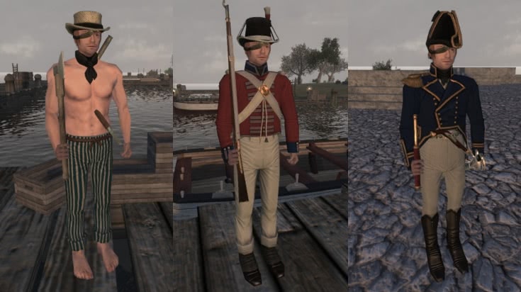
- Added the following new British units; Sailor, Marine and Post Captain.
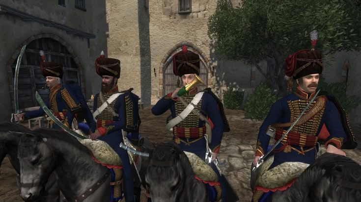
- Added the following new British units; First Kings German Legion Hussars.
- Added the following new French units; Sailor, Marine and Post Captain.
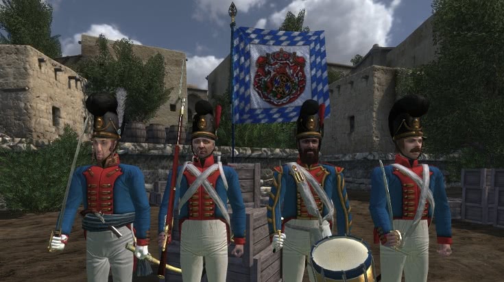
- Added the following new French units; 2nd Kronprinz Bavarian Infantry.
- Added pirate voices for the British sailors.
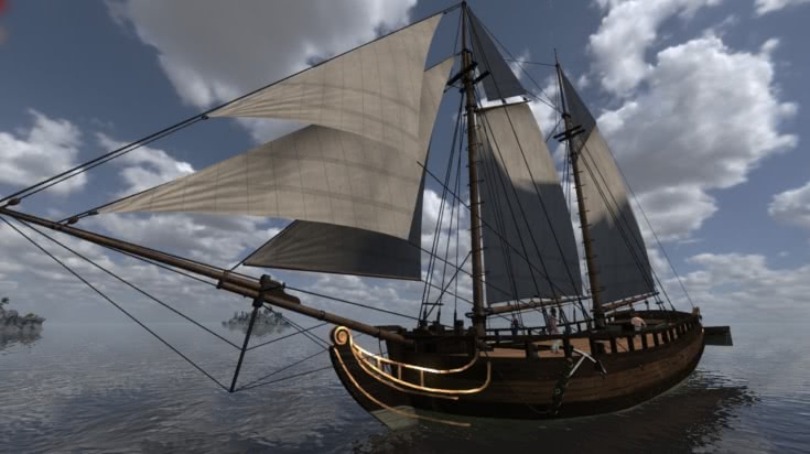
- Added a new big Frigate ship scene prop.
- Added a new sailable Sloop.
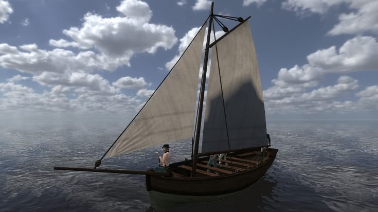
- Added a new sailable Rowboat.
- Added a new sailable Rowboat with 1 mast.
- Added a new sailable Rowboat with 2 masts.
- Added a new sailable Cannonboat (Can not fire)
- Added a new sailable Rocketboat (Can not fire)
- Added a lot of exciting new maps and map fixes.
New Maps
Battle
- Ambush
- Saint’s Isle
- Forest Palisade
- Sjotofta
- Naval Battle
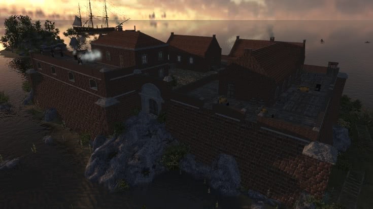
Siege
- Fort al Hafya
- Fort de Chartres
- Citadelle Napoleon (Naval)
- Charge to the Rhine
- Siege of Toulon (Naval)
- Fort George
- Fort Bashir
- Fort Nylas
- Fort Brochet
General Changes
- When a unit dies that carries a shovel in his backpack, it will always be dropped on the floor so people can pick it up and use it to remove earthworks that might be in the way.
- When a unit dies that carries a Ramrod in his backpack, it will always be dropped on the floor so people can pick it up and use it.
- Added a extra caption to Internal Admin chat, so you can tell them apart.
Balance Changes
- Reduced the length of the cavalry swords a bit, they had ghostly long range.
- Made all artillery less accurate on long range to balance the powerfull destruction force.
- Reduced the range an explosion would have by 30%, to balance the extremely powerful howitzers and mortars.
- Made cannonballs lose more force on ground hit and bounce less to make them less unstoppable.
- Made pistols some more accurate, it will now really hit within the player visible circle, to balance them, the reload is now slightly slower though.
- Decreased the damage the rifle in melee would inflict, they were more powerful than most real melee weapons
- Increased the Rifle Melee swing animation speed.
- Reduced the health of all medium and heavy horses to balance their classes.
- Made the armor points of the british cavalry helmets to be on par with other factions helmets.
- Removed the blunderbuss from the selection for russian dragoon cavalry they were too powerfull for that class.
- Boats respawn much faster now.
- Changed several maps to make them more balanced.
Bug Fixes
- Fixed a bug with some rocks uses in maps that were not having a collision mesh which allowed people to hide in.
- Fixed all collision meshes for trees, should now not block bullets on wrong places, and some trees were walk through, now not anymore.
- Fixed collision mesh for the sandbags which will now block bullets on the right places and not in thin air.
- Fixed collision mesh of the couch so it won't block bullets in thin air.
- Fixed that when you switch your weapon to melee you would walk slower.
- Fixed all cases that some ranks and some units were running faster or slower than others.
- Fixed several bugged collision meshes.
- Fixed several bugs on maps.
- Fixed a bug in the admin panel that it sometimes selected the wrong player, or does not work at all when clicking a player.
- Fixed a bug that allowed the prussian guard drummer to ride horses.
- Fixed a glitch that allowed you to teleport into a building by playing a piano from it’s backside.
- Fixed an exploit that allowed you to play two tunes at once as a musician.
- Fixed a bug in siege that some doors are reversed, can be walked through when closed and so on.
- ze_treasure prop will now always give out pirate hats to the user.
- Fixed a bug that spawned birds randomly on all custom maps.
People, I think this patch completely destroyed the commander battle gamemode. The gamemode is heavily bugged and unplayable!
Everytime someone in the server spawns they get automaticly kicked for cheating. It also takes ages to spawn and then that happens!
I'm not sure if this happens to everyone but me and a couple friends of mine are experiencing this horrific bug.
R.I.P Commander Battle
If I were to try out mapping a bit, would it be possible for me to attach stuff to the movable sloop? Like those little rail-cannons, or a ladder?
Ah thx for enlighten me, Olaf!
How long will Vince be not there? That's a bit odd on a release day!
Would you guys happen to have any BCOF updates in the future? It's been a while.
Nice job with the addition of more units and ships, you guys really went over the top with this patch.


2. Trolling, insulting and other personal attacks
Personal attacks on forum users and moderators of any kind will not be tolerated. This includes (but it is not limited to) insults, provocations for the sake of argument, threats, encouragement to suicide, wishing death or ill upon a user and death threats or threats to the persons physical constitution. The latter (in the threats category), in the absence of humor, is a criminal offense and will result in an immediate ban. Discussions are allowed, but only constructive discussions, not discussions where your main goal is to humiliate or offend someone. Aim to discuss points rather than people.

